

Terraso Story Maps
Place-based storytelling for change-makers
Inspire your audience with a free, easy to use, and powerful tool for place-based storytelling. Share data, media, and narratives on a map to ground your story in the land.
Why Terraso Story Maps?
Free, open source, and collaborative
Built from the ground up for nonprofits.
Easy to use
Accessible to mapping experts and newcomers alike.
Rich storytelling tools
Share images, videos, and geospatial data.
Share your story anywhere
Story maps display well on desktop and mobile devices. Share a link or embed on your website.
Terraso Story Maps for Environmental Storytelling
Tie stories to a place
Ground your narrative with high-resolution satellite imagery and 3D maps.
Powerful tool, simple experience
Build a delightful story, whether you are an expert or new to maps.
Display rich media
Engage your audience with video, images, and geospatial data.
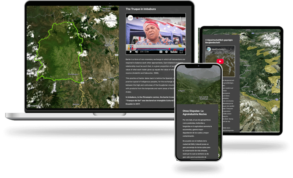
View this interactive story map by scrolling down in the screen:

“I went to Felt, I went to ArcGIS, they wanted so much money. I’m just a nonprofit trying to tell a story. But when I showed my team what I could do with Terraso for free, they were so impressed.”
– Madhuri Mandava, Paani Earth
Terraso Story Maps for Nonprofit Impact Reporting
Engage your audience
Break free from PDFs. Share interactive content to hold your audience’s interest.
Visualize your impact
Represent your work with geospatial data tools.
Expand your reach
Embed your stories on your website or blog. Share through social media.
View this interactive story map by scrolling down in the screen:

“By integrating mapping, data collection, knowledge sharing, and monitoring tools, I have been able to: Promote regenerative farming that supports livelihoods and ecosystem health. foster community ownership of natural resource management, and ensure data-driven decision-making for measurable and sustainable impact. This has empowered my community to adopt practical, long-term solutions to environmental and socio-economic challenges, contributing to resilience, sustainability, and improved quality of life.”
– Anonymous survey submission
Terraso Story Maps for Environmental and Social Advocacy
Ground your message in the land
Reveal boundaries, action sites, and geographic features with data.
Share the voice of your community
Share your most compelling videos, audio clips, and pictures.
Reach your audience everywhere
Perfect for presentations whether your audience has a big screen or a smartphone.
View this interactive story map by scrolling down in the window:

“Personally, I think Terraso’s Story Maps tool is a turning point in how we tell stories. Through its accessibility, it offers something deeply transformational for countries like mine, where many forgotten human stories have played out on our shared landscapes. Uncomfortable but true stories of colonization, enslavement and indentureship; stories of how our ancestors shaped and reshaped this land, leaving marks that can be seen from space. Marks that seem to speak from our past, saying ‘we were here’.”
– Damian Fernades, Conservation International Guyana
Trusted by change-makers around the globe
100+
Story Maps authors
26+
Countries represented by authors
24,000+
unique viewers of Terasso Story Maps