We just released a new set of features in Terraso – this time we’re focused on collaboration and mapping.
Sharing Links and Files
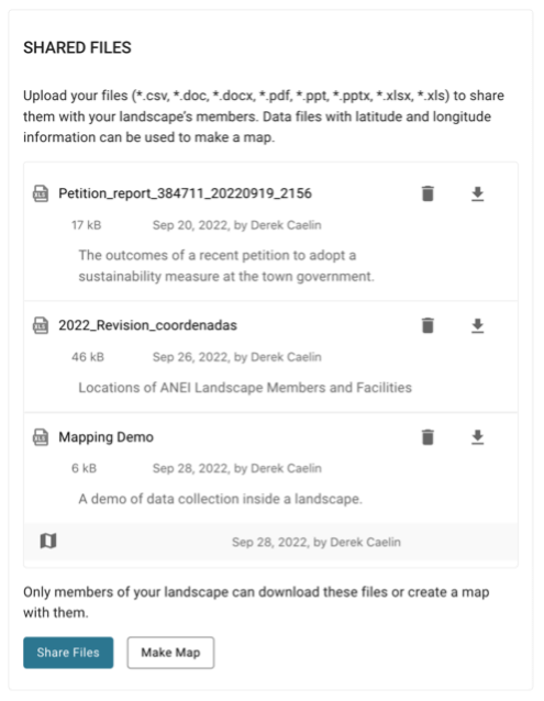
Our co-design partners have wanted a way to share all sorts of files with their close collaborators or more broadly at the landscape level, including documents, spreadsheets, reports, and presentations. Many reported that different organizations maintained their own file sharing systems and they struggled to share files among themselves. The current Terraso release lets users share files (and links to resources) at a group or landscape level. Now, members of your community can easily access and use your files.
Watch our YouTube video, Data Sharing with Terraso to learn more.
Data Mapping
Co-design partners have routinely expressed the challenge of creating maps and sharing them. Without a mapping specialist, landscape members lack this critical tool for organizing and sharing information at a landscape level.
Our work over the past few months has been to lower this barrier. Now in Terraso, if you upload and share a data file with latitude and longitude columns, you can quickly and easily create a map.
Simply go through a five-step process, and you’ll have a map ready to share with your collaborators and your landscape. Viewers will be able to explore data points on the map, selecting them to learn more about what happened at that place.
For this first mapping tool, the user will be able to utilize Excel and CSV files to upload the raw data. In upcoming releases, we will accept many more file formats, including geojson, KML/KMZ, and shape files. We also expect to generate maps with multiple layers.
To see the mapping tool in action, check out our YouTube Video: Introducing Data Mapping on Terraso.

How to Get Started
To use either of these new features, simply log into Terraso, create an account, and join a group. In the “Shared Files and Links” module, you’ll find the options to share resources and make maps! We’re looking forward to getting your feedback on these new features.