Terraso’s latest update brings the ability to attach geospatial data to story map chapters.
Among other things, this update allows you to:
- Showcase Land Management Plans: Follow in the footsteps of our partners at Heifer International, who used Terraso to highlight how Honduran ranchers restored their land through a new rotational grazing plan.
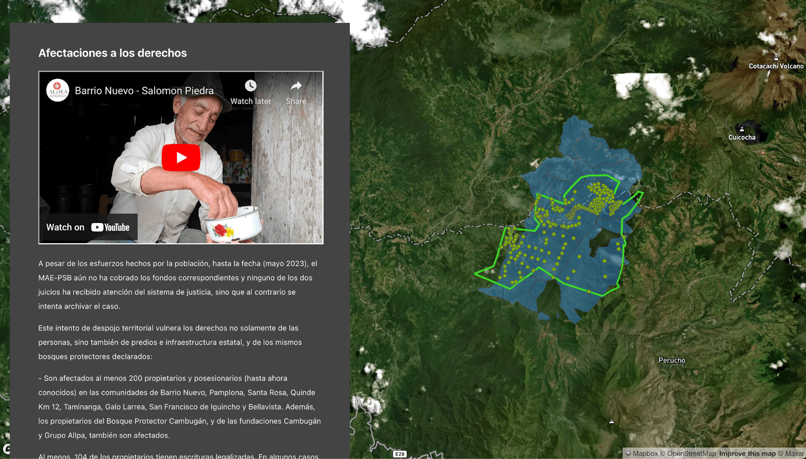
- Present Research Data: Make your research data accessible by presenting it layer by layer. ALDEA did just that using the map layer feature to present a detailed report on carbon credit theft in Ecuador.
- Document Territories: Help your audience understand the zones owned and managed by indigenous groups by documenting these territories with precision.
The data in story maps feature was frequently requested by our co-design partners, and we are grateful for their input. A special thank you to our colleagues at AlVelAl, Heifer International, CI-Guyana, ALDEA Foundation, and everyone else who contributed to making this feature a reality.Getting started on your own story map with data layers is easy! Simply upload your data to a Terraso group or landscape, make a map, and embed as a layer in a chapter. Learn more about creating story maps.
Happy storytelling!