Tech Matters is developing the Terraso software platform by working with co-design partners — landscape leaders who have agreed to help us test solutions to landscape challenges as a part of the 1000 Landscapes for 1 Billion People initiative. Tech Matters is a technology nonprofit organization with deep expertise supporting the social good sector with open-source software solutions. In this ongoing series, we share stories about our landscape co-design partners and how we are working together to find and improve tools for Terraso.
Reforestamos Mexico is a driving force for conservation and sustainable development. From forest restoration to establishing sustainable supply chains, the nonprofit serving eight Mexican states works at the level of landscapes, the mosaics of interdependent natural and human-made ecosystems that can span hundreds of thousands of square miles. We knew they had much to teach us.
That’s why the Terraso team has been working with Reforestamos since late 2020. With their guidance, we have developed a clearer understanding of one of the most challenging issues landscape leaders face: accurate monitoring of what is happening on the ground. Together, we’ve uncovered a potential solution using free and open-source tools.
Mapping and monitoring a landscape can be an enormous task. At 15,000,000 hectares, Corredor Biocultural del Centro Occidente de México, where Reforestamos works, covers more land area than Bangladesh. It’s the largest landscape the Terraso team supports today, a broad area comprising tropical and subtropical forests, desert, mountainous terrain and cities and villages home to around 25 million people.
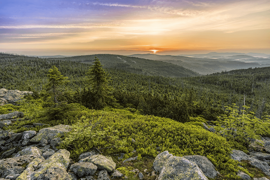
Photo credit Reforestamos Mexico
At such a large scale, tracking landscape changes can tax even the most dedicated teams. Mapping efforts are so resource intensive that this critical work may become very difficult to achieve. Slow Internet speeds make downloading large files difficult, and specialists must obtain large map files from public repositories like Copernicus and USGS. After obtaining these maps, they apply complicated machine-learning processes to train a computer to recognize what it sees in the imagery.
Using these methods, Reforestamos spends countless hours mapping the landscape, downloading large satellite maps, performing analyses, and identifying new areas where trees have disappeared (often near urban and agricultural centers). The result is a hard-earned “land use, land cover” map that details the makeup of a landscape. This vital piece of information allows them to identify where they need to dedicate their resources to restoring trees and establishing sustainable supply chains.
Ernesto Herrara, Reforestamos Mexico’s director, described the countless human hours that must be dedicated to the project. “Sixty percent of their time they have to be analyzing and … defining what data should be placed in the map,” he says. “Only 40 percent of the effort is performed by the computer.”
This balance means that every map is quite costly in terms of team time. Further, many office computers struggle to handle the complex calculations necessary to complete the analysis. “It takes a long time to process information… 20 or 29 hours. And sometimes the computer collapses, and you have to start all over again,” said Reforestamos GIS specialist Juan Esteban Torres Vivar. The
Added to the time it takes to download the large satellite image, it can be very challenging for a team to successfully use maps in their landscape management work.
Mapping inefficiencies are a common problem we at Tech Matters hear from landscapes. Like Reforestamos, other landscape co-design partners have frequently stressed the importance of maps and the goal of using them despite a low-bandwidth connection. We’ve committed to developing the Terraso platform with these needs in mind. To help Reforestamos and others who will eventually use Terraso quickly and efficiently generate land-use maps, we set out to find a solution that takes account of the environment faced by landscapes.
After scouring the Internet for tools developed by open-source providers, we discovered Sepal, a mapping and analysis tool developed by the Open Foris team at the UN Food and Agriculture Organization. Sepal is designed to make it easier for people to access and analyze satellite data.
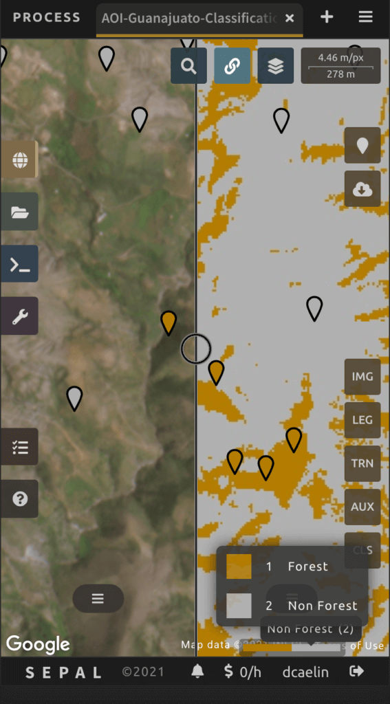
Built upon the Google Earth Engine, it tackles several Reforestamos challenges because accessing and processing images happens entirely in the cloud. Not only does this limit the time it takes to download large imagery files, it also provides the landscape team with access to powerful computers, maintained by others, which complete complex analyses in minutes instead of hours. Sepal further reduces the barriers to access by being mobile-friendly and translated into Spanish. Finally, the tool provides simple and yet powerful image-classification tools, making it possible for people without advanced GIS skills to create detailed land-use maps.
As a co-design partner, Reforestamos Mexico guides us on what tools and processes are valuable for them and for other landscapes that face similar challenges. The Reforestamos team applied Sepal to their typical mapping activities. They told us it could accomplish more than 80 percent of their analysis needs. Their initial deployment further suggests that the software could do even more by incorporating even higher resolution imagery.
At Terraso, our goal is to give landscape leaders access to powerful, accessible tools that help them manage their landscapes. When we find an opensource tool that solves 80% of a problem without any need for customization, we know the best way for us to provide value is to help develop that tool further rather than starting over from scratch. Reforestamos Mexico’s feedback and our other co-design partners help us to know how we might add value for both the tool creators and its users.
Our goal with co-design partners is to build value for both sides of the partnership, knowing that each of our early partners represents the needs of dozens or even hundreds of similar groups. We strive to provide tools and project support to landscapes even as they provide us with feedback and expertise. In doing so, we hope to do our part to create a greener, more sustainable world like the one Reforestamos is striving for. We will take the knowledge we have gained and incorporate it into Terraso, with a goal to serve 1000 landscapes, and beyond.